

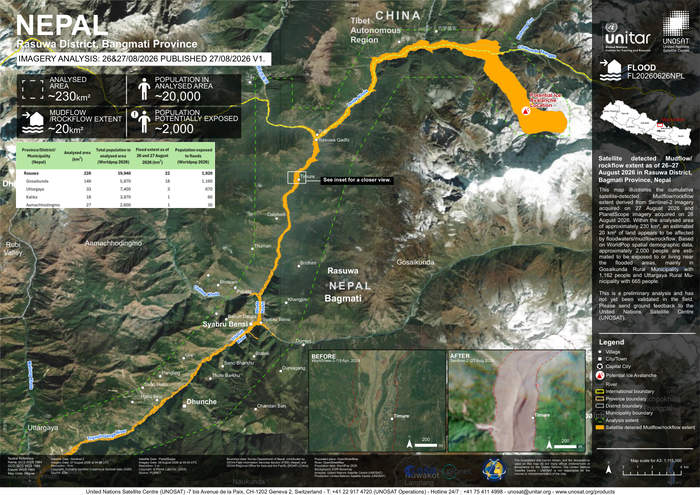
Country: Nepal Sources: The International Charter: Space and Major Disasters, UN Satellite Centre Please refer to the attached Map. This map illustrates the cumulative satellite-detected udflow/rockflow extent derived from Sentinel-2 imagery acquired on 27 August 2026 and PlanetScope imagery acquired on 26 August 2026. Within the analysed area of approximately 230 km2, an estimated 20 km2 of land appears to be affected by floodwaters/mudflow/rockflow. Based on WorldPop spatial demographic data, approximately 2, 000 people are estimated to be exposed to or living near the flooded areas, mainly in Gosaikunda Rural Municipality with 1, 162 people and Uttargaya Rural Municipality with 665 people. This is a preliminary analysis and has not yet been validated in the field. Please send ground feedback to the United Nations Satellite Centre (UNOSAT).
Nepal: Satellite-detected Mudflow/ rockflow extent as of 26–27 August 2026 in Rasuwa District, Bagmati Province (Imagery Analysis: 26&27/08/2026 Published: 27/08/2026 V1)

RELATED ARTICLES