

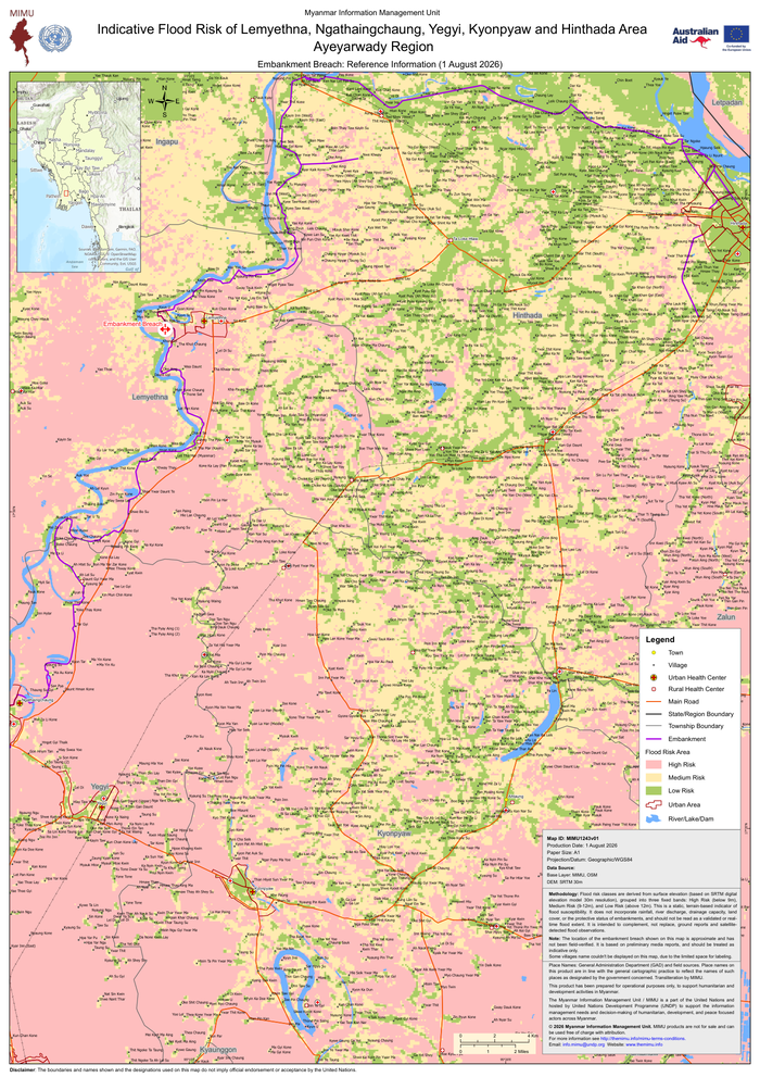
Country: Myanmar Sources: Myanmar Information Management Unit, UN Development Programme Please refer to the attached Map.
Myanmar: Indicative Flood Risk of Lemyethna, Ngathaingchaung, Yegyi, Kyonpyaw and Hinthada Area Ayeyarwady Region – Embankment Breach: Reference Information (1 August 2026)

RELATED ARTICLES